
Avenza Maps
Central Services | GIS
Locate Yourself And Interact With Maps On A Mobile Device
Have you ever wished you could see your location on a topographic map? We now offer the ability for you to do just that using your mobile device. Introducing the Avenza Maps application. The Avenza Maps application provides a number of mapping features including the ability to view your position on the County’s topographic maps and various park maps even while you are disconnected from cellular service. Many maps in this application have a fee to them; however, maps made by our department are all free to download. If you would like to learn more about the application, visit Avenza's app features and frequently asked questions pages.

How To View Skagit County Maps Using Avenza Maps
To get started viewing County maps, follow these instructions:
- Download the App: Download the Avenza Map application from Google Play or the Apple App Store to your mobile device. Once the application is installed, you will need to load a map of the area you plan to visit. The first time you open Avenza Map it will ask you to “sign in”; however, you don’t need to sign in to use the application.
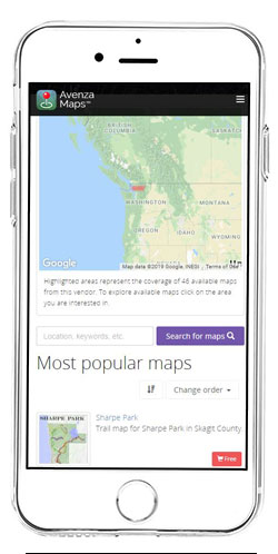
- Download A Map: From your mobile device, scan the QR code or open this list of Skagit County’s Maps. The Topographic Maps will be named 2018 Skagit Topo followed by the USGS Quadrangle name. For example, picking the “2018 Skagit Topo Marblemount” would pull up the Marblemount topographic map on the web page. Go to the Skagit County Topographic Maps page for more information on the topographic maps as well as an index map to help with finding the name of the map you want. There are also maps for various Skagit County Parks such as the Little Mountain trail map. Now pick the map you’re interested in by picking the “Free” shopping cart icon. You will be prompted to “Open in the Avenza Maps”. Select “Open” and then select the “Free” button followed by the “Install Now” button. The map will now be installed onto your mobile device. This may take a few minutes depending on your internet/cellular connection speed.
- Viewing Maps: While you are still in the Avenza Map application, pick “My Maps” in the lower left corner of the application followed by picking the map you just downloaded. The map will open and, if you are within the map extent, a blue dot will show up where you are standing (your GPS position). The application also has some fun tools you can access in the lower left corner including adding way points.
Have fun and be careful. These maps are for reference only. They are designed to give the user a general idea of where they are in the wilderness. They are not designed to show hazardous areas or other dangers associated with using maps.


