
DAIS Info
Central Services | GIS
Space Imaging's Digital Airborne Imagery System (DAIS-1) collects high resolution, multispectral aerial imagery for applications requiring a high degree of detail and accuracy. The superior detail and accuracy of the imagery produced by DAIS-1 makes it an excellent tool for both small area and linear analysis activities.
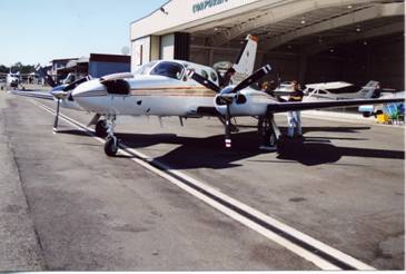
Fig 1.Beech Aircraft with DAIS refueling at Skagit Regional Airport.
DAIS-1 Features and Benefits
Collection Features Provide More Data Content
The main advantage of DAIS-1 is its ability to collect 12 bits of data per light band; thus, giving you 20 times the imagery content over traditional 8-bit systems. Because the 12-bit range can distinguish over 4,000 shades of gray, the shadowed areas of an image can be viewed, displayed, analyzed and mapped.
Another advantage is that DAIS-1 images can be collected on marginal flying days, increasing the ability to meet critical time and project deadlines.
System Capabilities Expedite ProcessingThe system was designed for fast turnaround of imagery products. The digital nature of DAIS-1 allows processing to begin immediately after the imagery is captured. Traditional aerial systems collect analog imagery, which requires additional processing steps before production can begin. Furthermore, differential GPS data and an inertial measurement unit (IMU) provide exact geographic position and camera attitude information, which also expedites image-processing time.
Calibration Provides High-Quality Image CharacteristicsTo ensure the radiometric quality of the data, Space Imaging contracted with the NASA Ames Laboratory to perform rigorous sensor calibration for a variety of data collection modes. The consistency and integrity of the images make them optimal for highlighting variations in vegetation and automated image classification.
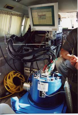
Fig 2. Inside the plane with the sensor and on board computer to collect and process data.
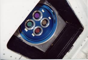
Fig 3. The sensors pointing out the belly of the plane.
DAIS-1 Imagery Applications
With its ability to provide distinction of objects from one-half meter to two-meters in size, DAIS imagery applications are ideal for:
Transportation and utility mapping
- Environmental assessments
- Urban development
- Disaster assessments
- Agricultural monitoring
- Real estate evaluation
Location and Collection Options
The DAIS-1 sensor is mounted aboard a Cessna 421-C airplane that can be deployed from Denver to any location in the Continental United States. The DAIS-1system supports three collection options for customers:
- Corridor Collections-Collects linear areas that are imaged in a single flight line, such as roads, pipelines, railroads and coastlines.
- Rectangular Collections-Consists of contiguous blocks of areas imaged in multiple flight lines, such as oil and gas fields, mines and forests.
- Point Target Collections-Collects small areas of interest that are imaged in a single flight line, or small areas such as agricultural fields, real estate properties and ecological areas.
Technical Overview
Image Products: Precision digital orthorectified color image mosaicks
Spatial Resolution: 0.5m (1.64ft), 1.0m (3.28ft), and 2.0m (6.56ft)
Geometric Accuracy: 4 meter CE90; 1.9m RMS
Spectral Resolution: B, G, R, NIR = 0.4-0.88 um
Radiometric Resolution: 12 bits per pixel = 4096 gray levels per pixel, per band or 8-bit conversion
Tiling Scheme: DOQQ, DOQQQ or custom
Format: GeoTIFF or ERDAS IMG
Projection/Datum: Wide variety available
Imagery Correction: Lens distortion, dark noise, optical vignetting, detector non-uniformity, terrain variation and tonal balance


